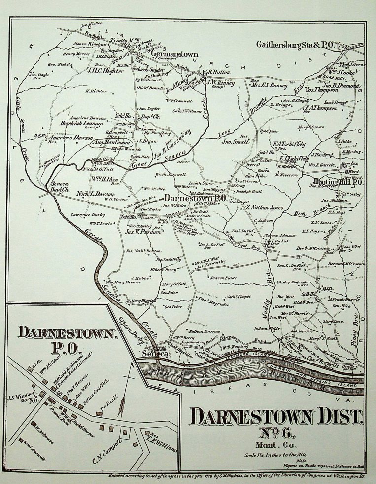
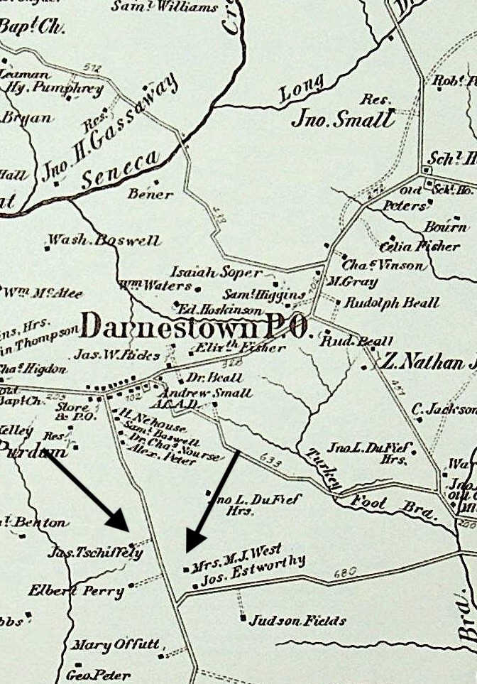
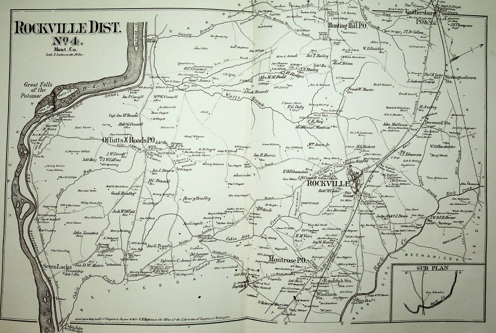
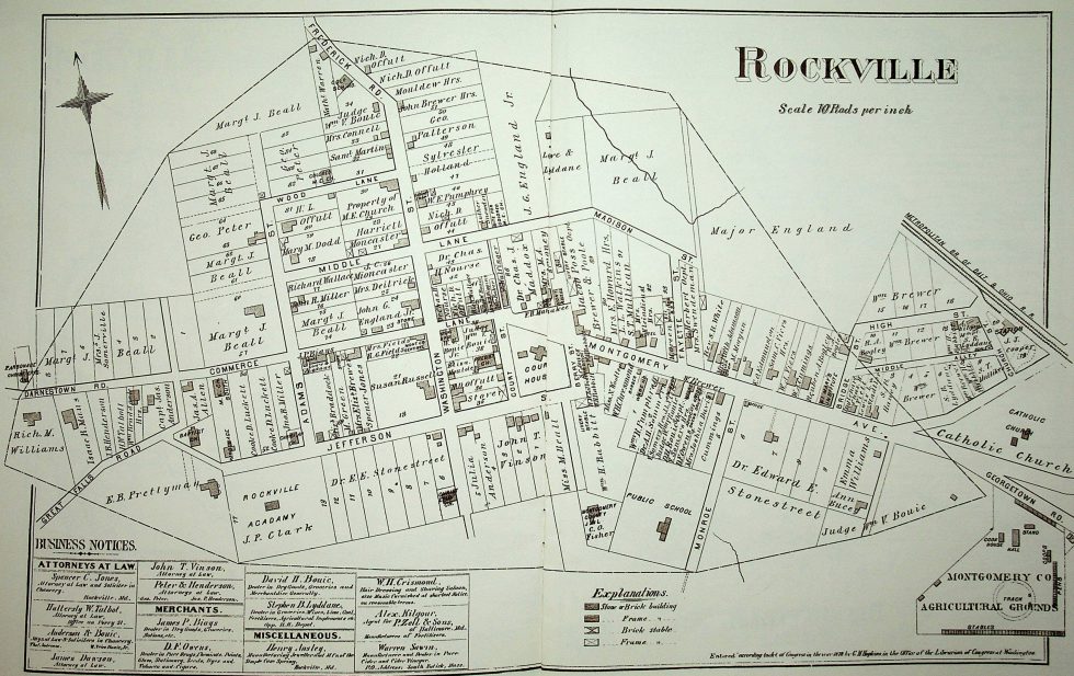
MAPS related to the lynching of John Diggs-Dorsey, 1880
These maps of Montgomery County provide context to the events of the 1880 lynching of John Diggs-Dorsey, geo-locating people and places as of 1878. G.M. Hopkins surveyed the entirety of the County and entered his atlas in the Office of the Librarian of Congress, Washington, DC, according to Act of Congress in the year 1878. This publication was accomplished according to subscription: those who appear on the map were listed as “patrons.” Official source information:
G.M. Hopkins: Atlas of Fifteen Miles Around Washington Including the County of Montgomery County, Maryland (Compiled, Drawn and Published from Actual Surveys), Garamond/Pridemark Press: Balitmore, MD 1975. (Originally published/engraved in Philadelphia, PA: 1879).
Click on each map to see more detail.